Upland Birds Seeing Red

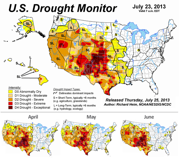
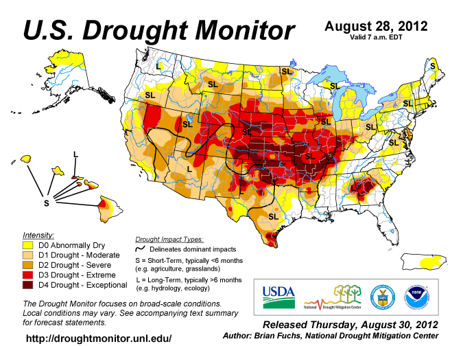
The US Drought Monitor Map gives a pretty depressing view for more than half the country. There is a distinct yellow to deep red tone painting most of the areas west of the Mississippi and south of the Oregon Trail.
The Drought Monitor uses a number of factors – soil moisture, streamflow, precipitation and more – to determine the severity of its classifications.
The good news is daily water requirements for most upland bird species are minimal. The bad news is that without rain both habitat cover and grain production are negatively impacted which has direct correlation to the success of bird populations.
There are a few bright spots in the country – Minnesota, Wisconsin, North Dakota, much of South Dakota and a fews areas in the Southeast and Northeast have managed to pull out of moisture deficits. Things should be looking up for game birds in those areas.
Beyond the maps, weather tends to be much more micro than the views they offer. These drought maps take a pretty broad brush to conditions which can vary from mile to mile. So there is still hope for your honey holes that may have received moisture that didn’t register on their grids.
The other bad news that comes with drought conditions is the emergency haying of land enrolled in the Conservation Reserve Program. Below is the latest map of counties that have been approved. Colorado, Kansas, Nebraska, Oklahoma and Texas will have birds facing cover challenges this fall and winter, and suitable cover for bird hunting could be difficult to find in these states.


